Marine
Weather for Coastal Waters Forecast from
Fenwick Island
Delaware, Ocean City Maryland, to Chincoteague
Virginia |
|
|
|
|
|
COASTAL SYNOPSIS:
. High pressure remains centered near the area tonight through the end of the week, bringing benign marine conditions across the local waters. Winds become elevated ahead of and especially behind a strong cold front crossing the local waters Saturday night. High- end Small Craft Advisory conditions or low-end Gale conditions are possible behind the front Saturday night into early Sunday.
|
OFFSHORE SYNOPSIS:
FOR MID ATLC WATERS...High pressure persists across the northern waters while a stationary extends across the southern waters. The front will slowly weaken into a surface trough tonight remaining along the Carolina coast into Fri. The high pressure area will expand with a warm front developing over the far N waters moving NE Fri. The high shifts E Fri night ahead of strong low pressure moving across New England. The low slowly moves across northern New England and into SE Canada Sat through Sun as its trailing cold front sweeps E across the waters Sat night and Sun. A secondary surface trough will move S over the area Sun night, otherwise high pressure will slowly build E over the waters Mon and Mon night, then persist across the region Tue and Tue night while slowly shifting E.
|
|
|
|
|
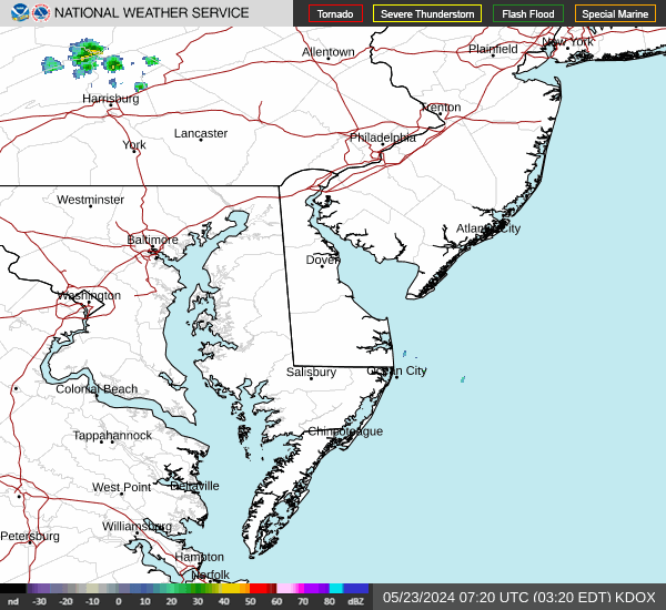
https://radar.weather.gov/ridge/lite/KDOX_0.gif
OFFSHORE FORECAST
-250830-
425 PM EDT Thu Apr 24 2025
.SYNOPSIS FOR MID ATLC WATERS...High pressure persists across the northern waters while a stationary extends across the southern waters. The front will slowly weaken into a surface trough tonight remaining along the Carolina coast into Fri. The high pressure area will expand with a warm front developing over the far N waters moving NE Fri. The high shifts E Fri night ahead of strong low pressure moving across New England. The low slowly moves across northern New England and into SE Canada Sat through Sun as its trailing cold front sweeps E across the waters Sat night and Sun. A secondary surface trough will move S over the area Sun night, otherwise high pressure will slowly build E over the waters Mon and Mon night, then persist across the region Tue and Tue night while slowly shifting E. ANZ825-250830- Baltimore Canyon to Cape Charles Light to 100 NM offshore-
425 PM EDT Thu Apr 24 2025
TONIGHT E to SE winds 5 to 10 kt. Seas 3 to 5 ft.
FRI SE winds 5 to 10 kt, becoming 5 to 15 kt. Seas 3 to 5 ft. Areas of fog with vsby 1 nm or less.
FRI NIGHT S winds 15 to 20 kt. Seas 3 to 5 ft. Areas of fog with vsby 1 nm or less.
SAT SW winds 15 to 25 kt. Seas 3 to 5 ft. Scattered showers with vsby 1 nm or less.
SAT NIGHT NW winds 15 to 25 kt. Seas 4 to 7 ft.
SUN NW winds 15 to 25 kt. Seas 4 to 7 ft.
SUN NIGHT NW winds 10 to 15 kt, becoming N. Seas 3 to 5 ft.
MON N to NW winds 5 to 10 kt, becoming variable. Seas 3 to 4 ft.
MON NIGHT S to SW winds 5 to 15 kt. Seas 3 to 4 ft.
TUE SW winds 10 to 15 kt, becoming S to SW 15 to 20 kt. Seas 3 to 4 ft.
TUE NIGHT S to SW winds 20 to 25 kt. Seas 3 to 6 ft.
|
-251415
Coastal waters from Fenwick Island DE to Chincoteague VA out
20 nm
958 PM EDT Thu Apr 24 2025
OVERNIGHT
SE winds 10 kt, diminishing to 5 kt late. Seas
around 2 ft. Wave Detail: SE 2 ft at 10 seconds.
FRI
SE winds 5 kt, increasing to 10 kt in the afternoon. Seas
2 to 3 ft. Wave Detail: SE 3 ft at 9 seconds.
FRI NIGHT
S winds 10 to 15 kt with gusts up to 20 kt. Seas
3 to 4 ft, occasionally to 5 ft. Wave Detail: SE 4 ft at
5 seconds and SE 4 ft at 9 seconds. A chance of showers after
midnight.
SAT
S winds 15 to 20 kt with gusts up to 25 kt. Seas around
4 ft, occasionally to 5 ft. Wave Detail: S 4 ft at 5 seconds and
SE 2 ft at 9 seconds. Showers likely.
SAT NIGHT
W winds 15 to 20 kt, becoming NW after midnight.
Gusts up to 30 kt. Seas 4 to 5 ft, occasionally to 6 ft. Wave
Detail: NW 4 ft at 4 seconds and SE 4 ft at 7 seconds. A chance
of tstms in the evening. Showers likely.
SUN
NW winds 15 to 20 kt, diminishing to 10 to 15 kt in the
afternoon. Seas 3 to 4 ft, occasionally to 5 ft.
SUN NIGHT
NW winds 10 to 15 kt. Seas 2 to 3 ft.
MON
NW winds 10 kt, becoming S in the afternoon. Seas around
2 ft.
MON NIGHT
S winds 10 kt. Seas around 2 ft.
Winds and seas higher in and near tstms.
|
|
|